|
GeoEnviron is an Environmental Health database
management system dedicated to managing data gathered
from routine inspections, complaint investigations and
monitoring activities.
The idea of the ‘sites’ is central in the
GeoEnviron system concept. A site is essentially a
location where activities with the potential to have an
impact on the environment and\or health have either
occurred or are occurring. In other words, sites are
locations that have attracted the attention of the
Environmental Health Officers because of issues related
to compliance with environmental legislation.
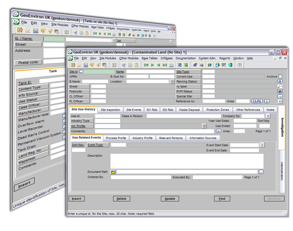
Sites are registered within specific application
modules depending on the type of environmental problem
being investigated (i.e. nuisance complaint addresses,
food outlets, industrial processes, contaminated sites
etc.). Once the site is registered and a case has been
created, the application module is used to keep a track
of the progress of investigations related to the site.
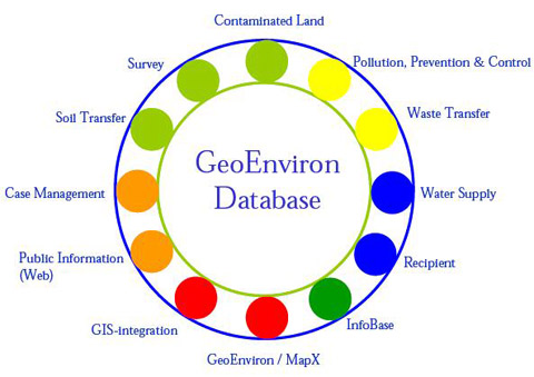
The applications that are currently available as parts
of the GeoEnviron system are shown in the figure below.
The system is modular in design, giving the user the
flexibility to implement the system selectively.
As well as storing data directly within the database,
GeoEnviron also gives you the opportunity to easily
manage externally located data in different formats
(i.e. text documents, spreadsheets, digital and scanned
photos, maps, drawings, video etc).
Figure: Overview of
the application modules
The ability to visualize data spatially is crucial to
strategic environmental planning and management. To
this end, GeoEnviron has been integrated with standard
geographical information systems (GIS) such as MapInfo
and ESRI.
In the case of MapInfo GIS, the user has the opportunity
to choose between an embedded MapX solution (GeoMap) or
an integration to MapInfo Professional.
The GeoMap solution has the advantage of giving you the
possibility of providing direct read/write map access to
officers at low cost and with little effort.
The governments ‘e-vision’ requires that local
authorities make their services and the information
they possess more available electronically.
The GeoEnviron system also offers a series of web
browser based solutions that give you the opportunity to
efficiently share data contained in the database with
both internal colleagues and the public.
Figure: GeoEnviron is designed for capturing data at a local level and facilitating its communication to regional and central authorities and the public.
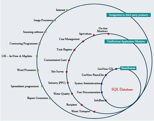
The Product
The GeoEnviron system consists
of 3 integrated components:
-
a powerful SQL relational database management system
(RDBMS)
-
powerful geographical information system (GIS)
capabilities
-
web solutions that allow data contained within the
system to be output to an Intranet or Internet
The RDBMS consists of a series of application modules
dedicated to managing data gathered from desk top
studies, site investigations, routine inspections,
complaint investigations and monitoring activities. The
system has a modular structure allowing you the
flexibility to purchase individual applications
separately.
As well as storing data directly within the database,
GeoEnviron gives you the opportunity to integrate to a
wide range of third party software applications (i.e.
word processors, spreadsheets, document imaging
programs, etc).
More details on the application modules and the GIS and
web solutions available can be obtained via the
hyperlink menu or from the GeoEnviron Product Catalogue
to the right of this page.Example:

Use the menu to the right of the page to navigate around
the site. Please do not hesitate to
contact us to discuss your
requirements.
|