|
Handling waste and waste streams includes huge amounts
of data to be treated accurate and fast. A long row of
stakeholders are involved for example waste producers,
waste carriers, treatment and disposal plants, waste
authorities, consultants, and the public.
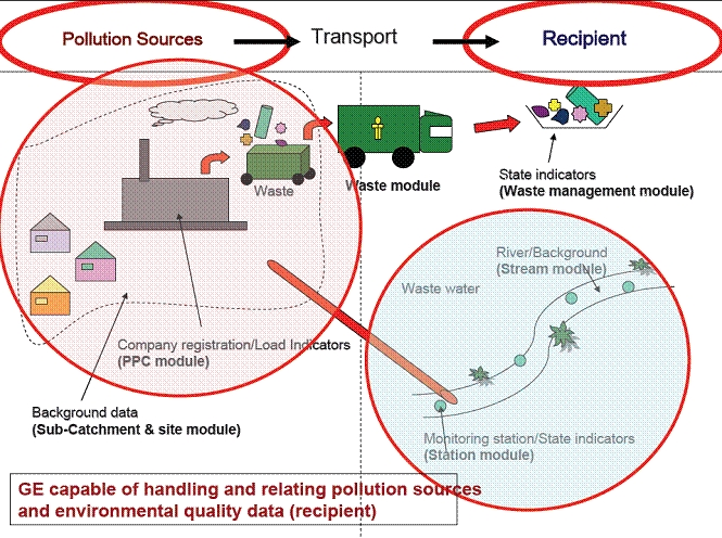
Impact from waste streams has to be considered using
information of affected recipients such as surface
waters, water catchment areas, eco localities, and urban
settlements.
GeoEnviron Waste Managing module is used by the
authorities as well as concessionary waste handling
companies for mapping waste amounts, waste types, and
waste streams in a ‘cradle to grave’ concept.
Detailed information on producers, carriers and
treatment facilities is handled in the module together
with information of the individual transportations or
group of transportations. As we are talking of complex
and considerable amounts of data the module holds
import/export facilities with intelligent data
validation.
 
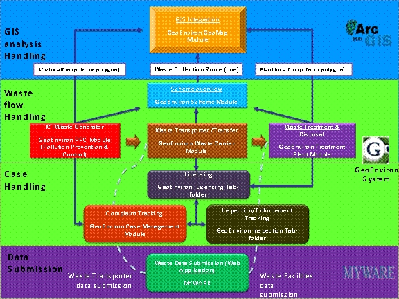
Overview of waste data in GeoEnviron and integration
with examples of GIS and Web Application front end for
data validation.
Other Modules
The
possibilities of expanding the Waste Management module
to include other relevant / inter-related data present
another key advantage for GeoEnviron.
Relevant
modules for future considerations can include for
example:
-
Contaminated land - relevant for landfill rehabilitation
-
Recipient
module - documentation of ambient environmental status
(rivers, water quality, monitoring stations etc.)
- Water
supply module - documentation of water intake, treatment
plant information.
|